
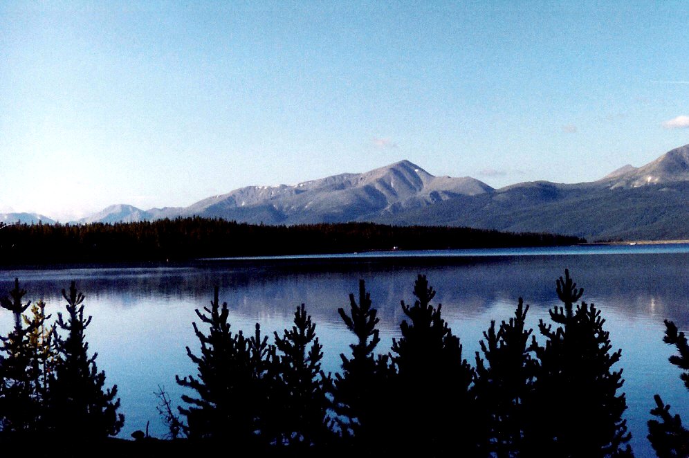
There are scenic drives where the mountains are something you look at through the windshield.
Then there is the Top of the Rockies Scenic Byway, where much of the drive already feels like the top of the map.
The 115-mile route connects Leadville, Twin Lakes, Independence Pass, Fremont Pass, Tennessee Pass, Red Cliff, Minturn, and Aspen through some of Colorado’s highest highway country. Along the way, it crosses the Continental Divide three times and traces the Arkansas River nearly to its source.
For anyone exploring the Arkansas River corridor, this drive adds important context. The broad river around Buena Vista and Salida begins as cold mountain water gathered from the high country around Leadville and Fremont Pass.
Fall is an especially good time to explore the route, but by mid-October the season is changing fast. High passes can see snow well before the valleys do, and Independence Pass closes for winter each year. Check current conditions before you leave.
What Is the Top of the Rockies Scenic Byway?
The Top of the Rockies is both a Colorado Scenic and Historic Byway and a federally designated National Scenic Byway.
Colorado Department of Transportation lists the complete route at 115 miles with about four to five hours of driving time. That is useful for understanding the scale of the route, but it is not a realistic sightseeing schedule.
If you stop in Leadville, walk around Twin Lakes, explore Independence Pass, visit Turquoise Lake, or spend time at Camp Hale, you can easily turn a section of the byway into an entire day.
That is the better way to do it.
The route is not really about getting from one end to the other. It is about using the road to connect places that are worth stopping for.
For the official route overview, see the Colorado Department of Transportation Top of the Rockies page.
The Arkansas River Is Part of the Story
One of the most interesting things about this drive is how closely it follows the beginning of the Arkansas River.
CDOT describes the route as tracing the Arkansas nearly to its source in the vicinity of Fremont Pass.
From there, the river grows as it moves through the Leadville area, south toward Buena Vista, through Browns Canyon and Salida, and eventually into Bighorn Sheep Canyon, the Royal Gorge, and Cañon City.
If you have spent time rafting, fishing, camping, or hiking farther downstream, driving the upper byway is a good way to understand where all that water begins.
Start with our Leadville guide for more places to explore around the upper river.
Start in Leadville
Leadville is the natural hub of the byway.
At about 10,200 feet, it is the highest incorporated city in the United States. Yet the surrounding mountains make even Leadville feel low. Mount Elbert and Mount Massive rise southwest of town, both above 14,000 feet.
The landscape is only part of the story.
Leadville grew during Colorado’s mining era, when enormous fortunes came out of the surrounding mountains. Historic buildings, mining remnants, old roads, and abandoned sites still cover the district.
Walk Harrison Avenue, explore the historic core, and then use town as a launch point for the three major branches of the byway.
Take the Detour to Turquoise Lake
Turquoise Lake is not directly on the main byway, but it is close enough to Leadville to be worth the side trip.
The reservoir sits west of town beneath Mount Massive and the Sawatch Range. Forest Service recreation sites around the lake provide access for fishing, picnicking, hiking, camping, and shoreline wandering.
By October, many seasonal campground services may already be closed or winding down, so check current Forest Service information before planning an overnight stay around a specific campground.
If you want to explore the area in more detail, see our Turquoise Lake guide.
Head South Toward Twin Lakes
From Leadville, U.S. 24 follows the Upper Arkansas Valley south toward Twin Lakes.
This is one of the most impressive sections of the drive because the Sawatch Range dominates the western horizon. Mount Elbert and Mount Massive rise almost directly from the valley floor.
Twin Lakes is worth a stop even if you do not continue over Independence Pass.
The lakes, historic community, shoreline, and mountain backdrop make it one of the most scenic places in the upper Arkansas River corridor.
From here, Highway 82 turns west and climbs toward the Continental Divide.
Independence Pass Is the Highest Branch
Highway 82 climbs from Twin Lakes to the Continental Divide at 12,095 feet.
Aspen forest gives way to increasingly open high-country terrain before the road reaches alpine tundra near the summit.
The summit has a short paved path to overlooks, but remember that 12,000 feet is real altitude. Even a short walk can feel strenuous, and temperatures can be dramatically colder than they were at Twin Lakes.
Bring a warm layer, even if the Arkansas River Valley feels mild.
For the full route, stops, vehicle restrictions, Independence ghost town, the Grottos, and the option of continuing to Aspen, see our Independence Pass driving guide.
Mid-October Means Check the Pass Before You Go
Independence Pass is seasonal.
CDOT says the pass typically closes on or near November 7, but weather can force an earlier safety closure. Snow, ice, rockfall, and rapidly changing conditions are normal concerns at this elevation.
Before driving the pass, check COtrip for current road status.
If Independence Pass is closed, that does not end the Top of the Rockies trip. Leadville, Turquoise Lake, Twin Lakes, Fremont Pass, and Tennessee Pass still offer plenty to explore, subject to local weather and road conditions.
Important: Independence Pass Has a 35-Foot Vehicle Limit
CDOT prohibits vehicles and vehicle-trailer combinations longer than 35 feet on the restricted section of Highway 82 over Independence Pass.
The road contains tight curves, steep grades, and narrow sections where two full lanes are not always available.
If your vehicle or combined rig exceeds the limit, use another route.
Follow the Arkansas Toward Fremont Pass
From Leadville, another branch of the Top of the Rockies heads north on Highway 91 toward Fremont Pass.
This is the section that most clearly connects the scenic drive to the Arkansas River’s beginnings.
The landscape becomes increasingly high and open as the road climbs north. Mining is part of the scenery here too, and the contrast between large-scale mining and the surrounding peaks is hard to miss.
Fremont Pass crosses the Continental Divide at more than 11,000 feet between Leadville and Copper Mountain.
Drive this section after spending time along the river downstream and it becomes easier to appreciate how quickly the Arkansas grows from high mountain water into one of Colorado’s major rivers.
Tennessee Pass and Camp Hale
The third major branch runs northwest from Leadville over Tennessee Pass toward Red Cliff and Minturn.
Tennessee Pass crosses the Continental Divide at 10,424 feet.
Beyond it lies Camp Hale, one of the most historically significant landscapes along the route.
Camp Hale was built during World War II as a training center for the U.S. Army’s 10th Mountain Division. Soldiers trained here for mountain warfare in snow, cold, and high-altitude terrain before fighting in Europe.
The broader landscape is now part of the Camp Hale-Continental Divide National Monument.
If you are interested in Colorado history, this branch deserves more than a quick drive-through.
Three Crossings of the Continental Divide
One detail makes the Top of the Rockies especially unusual: the complete route crosses the Continental Divide three times.
- Independence Pass: 12,095 feet
- Fremont Pass: more than 11,000 feet
- Tennessee Pass: 10,424 feet
Those crossings are more than impressive elevations.
The Continental Divide determines which direction water ultimately travels across much of the continent. On the Arkansas side, water flows toward the Mississippi River system and the Gulf of Mexico. On the western side, water enters the Colorado River system and heads toward the Southwest.
You can cross that boundary three times in one scenic route.
Do Not Try to Do Everything in One Day
CDOT’s four-to-five-hour estimate describes driving time. It does not describe a good trip.
Choose a branch and actually explore it.
Option 1: Leadville and Turquoise Lake
Explore downtown Leadville, drive out to Turquoise Lake, and spend time along the shoreline. This is a good choice when high-pass weather is questionable.
Option 2: Twin Lakes and Independence Pass
If the pass is open and the weather is good, start at Twin Lakes, drive to the summit, and continue down the west side toward Independence ghost town and the Grottos.
Option 3: Leadville to Fremont Pass
Follow the Arkansas toward its headwaters and climb Highway 91 toward the Continental Divide. This is a good route for understanding the connection between mining, mountains, and the beginning of the river.
Option 4: Leadville to Camp Hale
Head over Tennessee Pass toward Camp Hale for a trip combining mountain scenery with World War II history.
Late-Fall Driving Requires More Preparation
By October, conditions in Leadville and on the high passes can change quickly.
Bring warm clothing, check the forecast, and do not assume conditions in Buena Vista or Salida tell you what is happening at 11,000 or 12,000 feet.
Use established pullouts for photographs. Do not stop in travel lanes or on narrow shoulders.
On long descents, use an appropriate lower gear rather than riding the brakes continuously. This matters even more in vans, pickups, RVs, or heavily loaded vehicles.
What to Bring
- Warm layers
- A rain or snow shell
- Water
- Sun protection
- Comfortable walking shoes
- An offline map
- A vehicle emergency kit
- Enough fuel for the route you choose
- Binoculars
- A camera
Frequently Asked Questions
How long is the Top of the Rockies Scenic Byway?
CDOT lists the complete route at 115 miles with approximately four to five hours of driving time. Plan considerably longer if you want to stop and explore.
Where should I start?
Leadville is the most practical hub because the route branches toward Twin Lakes and Independence Pass, Fremont Pass, and Tennessee Pass.
Does the byway follow the Arkansas River?
Part of it does. CDOT describes the route as tracing the Arkansas nearly to its source near Fremont Pass.
Is the route open year-round?
Most of the major highways are maintained year-round, but the Independence Pass section of Highway 82 closes seasonally. Temporary closures can also occur because of snow, crashes, construction, rockfall, or other conditions.
Can I drive an RV over Independence Pass?
Only if the total vehicle length complies with CDOT restrictions. Vehicles and vehicle-trailer combinations longer than 35 feet are prohibited on the restricted section of Highway 82 over Independence Pass.
Follow the River Until It Gets Small
If you spend enough time along the Arkansas River, eventually you start wondering where it all comes from.
The Top of the Rockies is one of the best ways to find out.
Drive north from the broad valley around Buena Vista and the river gets smaller. Continue through Leadville and the mountains get bigger. Follow the road toward Fremont Pass and eventually the Arkansas begins to look less like one of Colorado’s major rivers and more like what every river is at the beginning: cold mountain water finding its way downhill.
Then turn around and follow it south.
That little river will eventually pass Buena Vista, Browns Canyon, Salida, Bighorn Sheep Canyon, the Royal Gorge, Cañon City, and then leave Colorado entirely.
The Top of the Rockies is a beautiful drive.
For Arkansas River travelers, it is also the beginning of the story.
Keep Exploring the Arkansas River
Use Arkansas River Guide to follow the river from its high-country beginnings near Leadville through Buena Vista, Browns Canyon, Salida, Bighorn Sheep Canyon, the Royal Gorge, and Cañon City. Explore towns, camping, fishing, hiking, scenic drives, hot springs, and the public lands surrounding one of Colorado’s great rivers.