
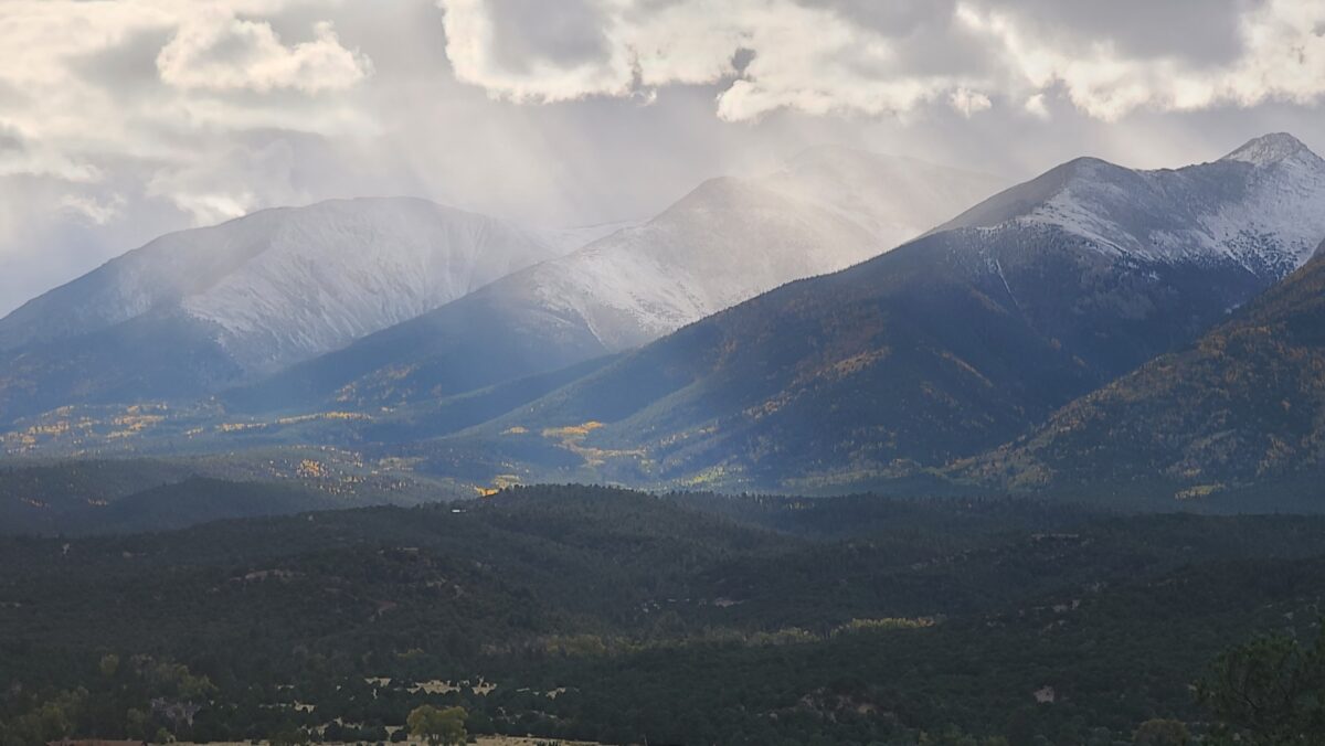
There is a point west of Salida where fall starts moving faster than you do.
Leave town on U.S. Highway 50 and the Arkansas River Valley is still broad and relatively low. Drive through Poncha Springs, begin climbing toward Monarch Pass, and every few miles seem to push the season forward.
Cottonwoods turn along the lower drainages. Aspens brighten the mountainsides. Spruce and fir take over higher up. By the time you reach the Continental Divide at more than 11,000 feet, a warm September afternoon in Salida can feel a lot more like October.
That elevation change makes Monarch Pass one of the easiest fall adventures from the Arkansas River Valley.
It is also particularly timely in 2026. The Colorado Department of Transportation warned on September 8 that drought and prolonged moisture stress could bring an earlier leaf season to parts of Colorado this year. CDOT’s current estimate puts central mountain color generally in the mid-to-late September range, while the highest passes may turn earlier.
In other words, if you are around Salida this September, do not wait until October to start looking.
Where Is Monarch Pass?
Monarch Pass carries U.S. Highway 50 across the Continental Divide west of Salida and Poncha Springs.
From Poncha Springs, the drive to the summit is about 18 miles. The road climbs steadily through the San Isabel National Forest before reaching the divide.
Colorado Department of Transportation data lists the highway summit at 11,312 feet, while the nearby Forest Service Monarch Crest trailhead is listed at about 11,386 feet.
Do not get too hung up on the few dozen feet of difference between various signs, maps, and nearby high points.
The useful number is 11,000.
You are high enough that weather, temperature, vegetation, and the timing of fall can be completely different from what you left behind in Salida.
If you are using Salida as your basecamp, start with our Salida visitor guide for more ideas around town.
Why Monarch Pass Works So Well for Fall Color
A good fall drive is not necessarily the road with the single biggest grove of aspens.
It is a road that crosses enough elevation and different landscapes to give you options.
Monarch does exactly that.
The route begins in the relatively dry Upper Arkansas Valley, climbs through mixed mountain forest, passes pockets and hillsides of aspens, and eventually reaches subalpine country near the Continental Divide.
That means the entire road does not turn at once.
Higher elevations generally change before lower ones. A grove near the pass may already be losing leaves while trees farther down toward Poncha Springs are still green.
That is especially useful in a year like 2026, when predicting one perfect “peak weekend” is even less reliable than usual.
Instead of trying to hit one exact date, drive through several thousand feet of elevation and see what you find.
2026 Fall Color May Be Early
This year deserves a little extra attention.
On September 8, 2026, CDOT advised fall travelers that drought and prolonged moisture stress could cause leaves in portions of Colorado to turn earlier than usual.
For the central mountains, current estimates generally place peak foliage from mid to late September. High mountain passes above 9,500 feet may begin changing in early to mid-September.
Those are planning estimates, not reservations.
Fall color is influenced by elevation, temperature, moisture, wind, individual tree stands, and sudden weather changes. A strong windstorm can strip a beautiful grove surprisingly quickly.
The practical advice is simple.
If the trees look good, go.
Do not postpone a beautiful September day because somebody on the internet predicted that next weekend would be “peak.”
For current travel information, check CDOT’s 2026 fall travel update and COtrip before leaving.
Stop at Monarch Pass
Do not treat the summit as nothing more than the point where the road starts going downhill.
Monarch Pass is a destination of its own.
There is parking near the summit, access to the Continental Divide Trail, and broad views into mountain country on both sides of the divide.
Even if you do not plan a serious hike, get out of the vehicle and walk around.
The Continental Divide is more interesting when you actually stand on it.
Water falling on one side ultimately drains toward the Arkansas River and Mississippi River system. Water falling on the other side enters the Gunnison and Colorado River system on its way toward the Southwest.
It is one of those geographical ideas that makes much more sense when you can look in both directions.
Walk a Piece of the Continental Divide Trail
You do not need to hike hundreds of miles to say you walked the Continental Divide Trail.
Monarch Pass provides easy access to it.
The Forest Service’s Monarch Crest section follows the Continental Divide south from the pass toward Marshall Pass for 11.5 miles.
You certainly do not need to walk the whole thing.
A short out-and-back from Monarch Pass is enough to get away from the highway, stretch your legs, and see the surrounding mountains from a different angle.
The trail begins at high elevation and has relatively little elevation gain compared with many Colorado mountain trails, but that does not make it effortless. At more than 11,000 feet, even a modest walk can feel surprisingly strenuous if you are coming from lower elevation.
Bring water, a warm layer, sun protection, and turn around before you are tired.
Also pay attention to other trail users. The Forest Service identifies the Monarch Crest as one of Colorado’s most popular mountain biking routes, and motorcycles are permitted on this section as well. ATVs and other four-wheel-drive vehicles are prohibited.
For current trail information, see the Forest Service Monarch Crest trail page.
Mountain Biking the Monarch Crest
For mountain bikers, Monarch Pass means something completely different.
The Monarch Crest is one of Colorado’s classic high-country rides.
The Forest Service describes the 11.5-mile Continental Divide segment between Monarch Pass and Marshall Pass as one of the state’s most popular mountain biking trails.
Many riders incorporate that section into longer routes that eventually descend thousands of feet toward the Arkansas River Valley.
September can be an outstanding time to ride it.
Cooler temperatures and fall color are hard to argue with.
But fall also adds uncertainty.
At this elevation, snow can arrive early. A storm that produces rain in Salida can leave snow or ice along the Continental Divide.
Check conditions immediately before riding rather than assuming that a dry trail in town means a dry trail on the Crest.
If you would rather stay lower, Salida has an extensive trail system where fall conditions may remain good long after high-country riding starts becoming questionable.
Keep Driving West, Even If You Are Coming Back to Salida
One of the mistakes people make at Monarch Pass is driving to the sign, taking a picture, and immediately turning around.
Keep going for a while.
The west side of the Continental Divide gives you a completely different perspective on the mountains.
U.S. 50 descends toward Sargents and eventually Gunnison, following valleys and drainages on the western side of the divide.
You do not need to drive all the way to Gunnison to make the detour worthwhile.
Pick a turnaround point based on time, weather, and what the aspens are doing.
Then drive back over the pass.
Mountain roads often look surprisingly different in reverse, especially in fall when light changes the color of entire hillsides.
What About Old Monarch Pass?
The modern U.S. 50 crossing is not the only Monarch Pass.
Just north of the current highway lies Original Monarch Pass, an older crossing of the Continental Divide associated with the historic Monarch Pass road.
The original route dates to Colorado’s early transportation and mining era, long before modern U.S. 50 carried regular highway traffic across the mountains.
Today the old pass is reached by an unpaved road rather than the main highway.
It can be an interesting side trip for properly equipped travelers when road and weather conditions are suitable, but do not treat it like an extension of the paved scenic drive.
Conditions can change quickly, and early snow or wet weather can make high-country dirt roads considerably more serious.
If you simply want scenery, the paved highway and trails around the modern pass provide plenty.
Watch the Weather, Not Just the Leaves
September is still summer on the calendar until the equinox.
Monarch Pass does not care.
High-elevation snow can arrive in early fall, temperatures can drop rapidly, and weather at the pass may have little resemblance to conditions in Salida.
CDOT specifically warns fall travelers to be prepared for early mountain snowstorms.
Bring an extra layer even if town is warm.
Before leaving, look at the actual mountain forecast and check road conditions on COtrip.
If weather is deteriorating, there is no prize for continuing over the pass.
Turn around and spend the day somewhere lower.
The Arkansas River corridor gives you plenty of options.
Use Your Transmission on the Way Down
Monarch is a real mountain pass, not a flat scenic highway with a summit sign.
CDOT lists grades around 6 percent on U.S. 50 over the pass.
Long descents can heat brakes if you ride the brake pedal continuously.
CDOT recommends using lower gears when descending steep mountain passes to reduce the chance of overheating brakes.
That advice matters even more if you are driving a van, pickup, RV, or heavily loaded vehicle.
Slow down before curves, use an appropriate lower gear, and let the engine help control your speed.
Do not wait until you smell hot brakes to start thinking about it.
Do Not Stop in the Road for Fall Color
This sounds obvious until somebody spots the perfect yellow hillside.
CDOT is specifically asking fall travelers not to stop in travel lanes or on narrow shoulders for photographs.
Use designated turnouts and parking areas.
Passengers can enjoy the scenery while the driver watches the road.
Monarch Pass carries normal U.S. 50 traffic, including trucks, motorcycles, RVs, cyclists, and travelers who are simply trying to get across the mountains.
A beautiful aspen grove is not a reason to create a traffic hazard.
Go Midweek If You Can
Colorado fall-color season has developed its own version of summer weekend traffic.
For 2026, CDOT is specifically encouraging Tuesday-through-Thursday trips where possible because mountain corridors can become crowded on peak foliage weekends.
That advice fits Monarch particularly well.
A quieter weekday makes it easier to find parking, stop at legitimate pullouts, walk a section of trail, and actually enjoy the drive rather than joining a procession of vehicles doing the same thing.
If you have flexibility, use it.
Build Monarch Pass Into a Salida Fall Day
You do not need to dedicate an entire vacation to the drive.
Morning: Start in Salida
Have breakfast in town and take a walk along the Arkansas River before heading west.
Cool September mornings are one of the best times to be downtown without rushing anywhere.
Late Morning: Drive Toward Monarch
Follow U.S. 50 west through Poncha Springs and begin climbing.
Take your time and use established pullouts when you want to stop.
Midday: Explore the Pass
Park near the summit and walk a short portion of the Continental Divide Trail.
If you are accustomed to elevation and conditions are good, extend the walk. Otherwise, there is nothing wrong with a short hike and a long view.
Afternoon: Explore the West Side
Continue down the western side for a while before turning around and crossing Monarch again.
If the weather changes, skip this part and head back toward the valley.
Evening: Return to the Arkansas
Finish back in Salida for dinner, walk along the river, or soak in one of the hot springs around the Upper Arkansas Valley.
Our Arkansas River hot springs guide can help you choose where to go.
Or Make It Part of a Bigger Arkansas River Road Trip
Monarch Pass works especially well because it can be combined with places that feel completely different.
Spend one day high on the Continental Divide and another following the Arkansas downstream.
From Salida, Highway 50 enters Bighorn Sheep Canyon and the Cotopaxi area, where dry canyon walls, river access, fishing, camping, and bighorn sheep habitat replace the high-elevation forests around Monarch.
Continue farther and you eventually reach the Royal Gorge and Cañon City.
Or head north from Salida toward Buena Vista, Browns Canyon, Nathrop, Twin Lakes, and Leadville.
That is one of the best things about traveling the Arkansas River corridor in fall.
You are not locked into one elevation or one landscape.
What to Bring
- A warm layer, even if Salida is warm
- A rain or snow shell
- Water
- Sun protection
- Walking shoes if you plan to explore the Continental Divide Trail
- An offline map
- A vehicle emergency kit
- A camera or phone with enough storage for far too many pictures of yellow trees
And bring enough fuel that you are not planning the entire day around the next gas station.
Frequently Asked Questions
Is Monarch Pass open year-round?
U.S. 50 over Monarch Pass is normally maintained as a year-round highway rather than seasonally closing like Independence Pass. Severe winter weather, avalanche mitigation, crashes, or other conditions can still cause temporary closures. Check COtrip immediately before traveling.
How high is Monarch Pass?
Colorado Department of Transportation data lists the U.S. 50 highway crossing at 11,312 feet. Nearby trailhead and high-point elevations vary slightly depending on exactly where they are measured.
When will fall colors peak at Monarch Pass in 2026?
There is no exact peak date. CDOT’s September 8, 2026 guidance says high passes above 9,500 feet may see peak foliage in early to mid-September, with central mountain areas generally peaking from mid to late September. Drought and moisture stress may make color earlier in some areas this year.
Can I hike from Monarch Pass?
Yes. Monarch Pass provides access to the Continental Divide Trail. The Forest Service’s Monarch Crest section continues 11.5 miles south toward Marshall Pass, but you can simply walk a short out-and-back if you want a much easier outing.
Can you mountain bike from Monarch Pass?
Yes. The Monarch Crest is one of Colorado’s best-known mountain biking routes. The Forest Service identifies the Continental Divide segment between Monarch and Marshall passes as a popular 11.5-mile mountain bike trail. Many riders combine it with additional trails for a much longer ride.
Is Monarch Pass the same as Old Monarch Pass?
No. Modern U.S. 50 crosses the Continental Divide at the current Monarch Pass. Original Monarch Pass is a separate historic crossing nearby reached by an unpaved road.
Fall Does Not Last Long Up Here
There is something about fall in the high country that makes procrastination a bad strategy.
A hillside can be green one week, yellow the next, and nearly bare after one windy storm.
Snow can cover the Continental Divide while cottonwoods are still changing along the Arkansas River thousands of feet below.
That short window is part of what makes Monarch Pass worth driving in September.
Do not worry too much about finding the perfect grove or the exact peak-color date.
Leave Salida.
Climb until the trees change.
Stop somewhere safe.
Walk for a while.
Stand on the Continental Divide.
Then head back down to the Arkansas River and watch fall start all over again.
Keep Exploring the Arkansas River Valley
Use Arkansas River Guide to explore Salida, Buena Vista, Browns Canyon, Leadville, Bighorn Sheep Canyon, Cañon City, scenic drives, hiking, biking, fishing, camping, hot springs, and the public lands surrounding Colorado’s Arkansas River.