
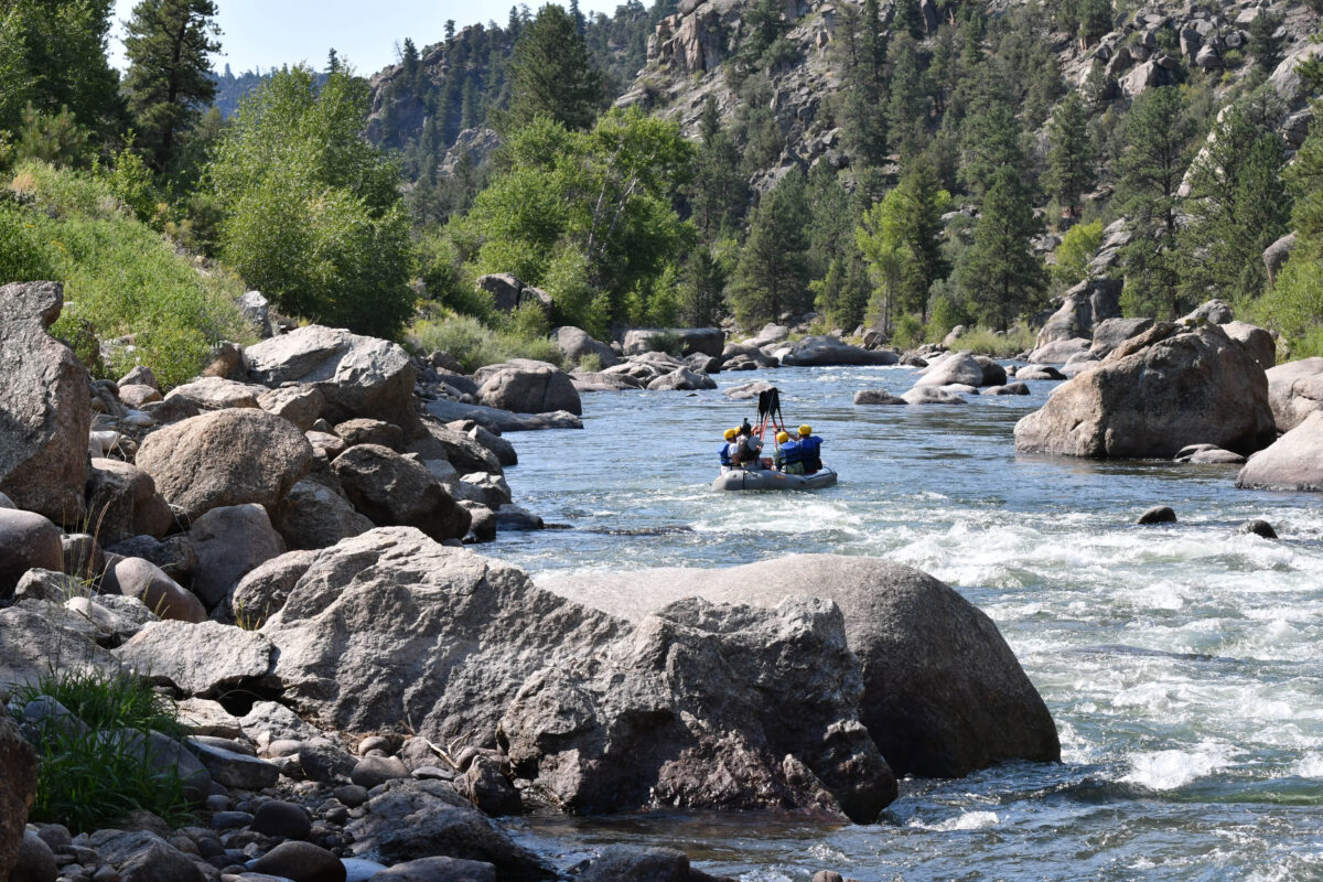
It is much easier to understand Colorado’s Arkansas River once you stop thinking about individual attractions and start looking at the river as one continuous corridor.
The section most visitors explore begins high in the mountains near Leadville, passes Buena Vista and Browns Canyon, flows directly through Salida, continues through Bighorn Sheep Canyon and then cuts into the Royal Gorge before reaching Cañon City.
This guide follows that route from north to south.
For individual communities along the way, see our Arkansas River towns guide.
1. Leadville and the Arkansas headwaters
The Arkansas begins high in the central Colorado mountains near Leadville.
This is not yet the broad river people see farther downstream. The upper drainage is colder, smaller and distinctly alpine.
The area around Leadville, Hayden Meadows and Twin Lakes is a good place to understand where the river comes from and how closely the Arkansas is tied to Colorado’s snowpack.
Best for: high-country scenery, fishing, camping, hiking and exploring the river near its beginnings.
2. Granite and Pine Creek
As the river moves south, it begins to gain volume and gradient.
Near Granite, the character changes dramatically. The channel narrows and the river enters serious whitewater country.
Pine Creek is one of the most difficult commonly discussed rapids on the upper Arkansas. Colorado Parks and Wildlife places this area in the advanced end of the river’s whitewater spectrum.
This is not an ordinary sightseeing float.
3. The Numbers
Downstream of Pine Creek is The Numbers, one of Colorado’s classic continuous whitewater runs.
The river moves quickly through a rocky mountain corridor, with named rapids arriving in succession. It is a popular guided trip as well as a destination for experienced private boaters.
Best for: athletic rafters and paddlers looking for sustained whitewater.
4. Buena Vista
The river reaches Buena Vista, one of the main recreation hubs of the Upper Arkansas Valley.
This is a useful place to pause geographically. North of town are technical sections such as The Numbers. South of town lies one of the most famous recreational stretches on the entire river: Browns Canyon.
Buena Vista also provides access to trails, hot springs, camping and the Collegiate Peaks.
5. Browns Canyon National Monument
South of Buena Vista, the river enters the granite landscape of Browns Canyon.
Browns Canyon National Monument protects roughly 22,000 acres of river canyon and uplands. The Arkansas River is the easiest way for most visitors to experience the interior of the monument.
The rafting run is known for Class III whitewater, granite formations and a feeling of separation from highways and towns.
Ruby Mountain and Hecla Junction are important recreation sites associated with this part of the river.
Several commercial outfitters operate Browns Canyon trips. Monumental Expeditions, based near Nathrop between Buena Vista and Salida, is one smaller local option serving this section.
Best for: classic Colorado rafting, families ready for Class III whitewater, scenery and national monument access.
6. Nathrop and the central valley
Between Buena Vista and Salida, Nathrop sits near the geographic center of many Upper Arkansas attractions.
Chalk Creek, Mount Princeton, hot springs, Browns Canyon and several camping areas are all nearby.
Nathrop itself is small, but its location makes it a convenient basecamp for travelers who plan to explore both Buena Vista and Salida.
7. Salida Valley
As the river approaches Salida, it moves into a broader valley.
The water here is generally more approachable than the technical sections north of Buena Vista. Scenic floats and beginner-friendly rafting are common.
The mountains remain prominent, but the character of the river feels more open.
Best for: younger families, scenic rafting, fishing and relaxed river days.
8. Downtown Salida
Salida is one of the rare Colorado mountain towns where the river is part of downtown rather than something visitors have to drive to.
The Arkansas passes Riverside Park and the historic district, and the Salida Whitewater Park adds another layer of activity for paddlers.
This makes Salida especially good for travelers who want river recreation in the morning and restaurants, shops or galleries later in the day.
9. Bear Creek and the upper Bighorn corridor
Downstream from Salida, the landscape begins tightening again.
The section toward Rincon and the upper part of Bighorn Sheep Canyon contains approachable but increasingly active whitewater.
It is a natural transition between the open Salida Valley and the longer canyon system farther downstream.
10. Bighorn Sheep Canyon
The Arkansas then follows Highway 50 through a long canyon toward Texas Creek and Parkdale.
This is Bighorn Sheep Canyon, known for a mixture of rapids, fishing water, rocky slopes and wildlife habitat.
Colorado Parks and Wildlife identifies this broader portion of the river as useful for rafting, fishing and wildlife viewing, with a wide range of whitewater difficulty depending on the subsection.
Best for: intermediate rafting, fishing, canyon scenery and visitors based around Cañon City.
11. Parkdale
Parkdale is the dividing line between two very different river experiences.
Upstream lies Bighorn Sheep Canyon. Downstream, the river enters the Royal Gorge.
For private boaters, this is not a place to casually continue downstream without knowing exactly what lies ahead.
12. Royal Gorge
Below Parkdale, the Arkansas River cuts into the Royal Gorge.
The walls rise dramatically above the river, the corridor becomes more committing and the whitewater steps into a more serious category.
The railroad follows the river through much of the gorge, while the famous Royal Gorge Bridge crosses high overhead.
This section is one of the most visually dramatic places on the Arkansas, but it is not a beginner float.
For guided rafting in this part of the river, Whitewater Adventure Outfitters is a longtime Cañon City-area operator running Royal Gorge trips as well as easier Bighorn Sheep Canyon trips.
Best for: experienced and adventurous rafters specifically seeking bigger whitewater.
13. Cañon City
After leaving the Royal Gorge, the Arkansas arrives at Cañon City.
The environment here feels different from Leadville and Buena Vista. Elevation is lower, summers are warmer and the surrounding landscape begins transitioning away from the high Rockies.
Cañon City makes a logical southern basecamp for exploring the Royal Gorge region.
Putting the whole river together
From north to south, a simple mental map looks like this:
Leadville → Hayden Meadows → Granite → Pine Creek → The Numbers → Buena Vista → Browns Canyon → Nathrop → Salida Valley → Salida → Bear Creek → Bighorn Sheep Canyon → Parkdale → Royal Gorge → Cañon City
Each transition changes the river.
The upper river feels cold and alpine. The Buena Vista corridor brings technical whitewater. Browns Canyon combines scenery and classic Class III rafting. Salida opens into easier family water. The river then tightens into Bighorn Sheep Canyon before committing to the walls of the Royal Gorge.
Use an official river map before launching
This guide is intended to help visitors understand the geography, not replace a navigation or boating map.
Private boaters should use the Colorado Parks and Wildlife Arkansas Headwaters river section information for access points, recreation sites and official river information.
Then use Arkansas River Guide to explore the rafting sections, campgrounds, fishing and towns that make this river much more than a single whitewater run.