

Trails, History & High Country
Chalk Creek Canyon
Follow Chalk Creek from Nathrop beneath Mount Princeton toward waterfalls, mountain lakes, historic railroad grades, St. Elmo, and the high country near the Continental Divide.
West From Nathrop
A Road Into the Collegiate Peaks
County Road 162 leaves the Arkansas River Valley at Nathrop and follows Chalk Creek west into the Sawatch Range.
The scenery changes quickly. The broad valley narrows beneath Mount Princeton and Mount Antero, pale cliffs rise above the creek, and trailheads begin appearing along the road.
Farther west, the canyon becomes increasingly historic. Old railroad grades, abandoned mine sites, former mining camps, and the preserved buildings of St. Elmo tell the story of the people who once tried to build towns and railroads deep into these mountains.
You can spend an hour here on a short waterfall hike or follow the canyon all day toward St. Elmo, Hancock, and the Alpine Tunnel.

The Basics
Chalk Creek Canyon at a Glance
Main Road
County Road 162
The canyon begins at US 285 in Nathrop and follows Chalk Creek west toward St. Elmo and the surrounding high country.
Short Hikes
Waterfalls & Railroad Trails
Agnes Vaille Falls and the Narrow Gauge Trail provide shorter hiking options without requiring a full high-country day.
Longer Trails
Colorado Trail
The Chalk Creek Trailhead sits directly on the Colorado Trail, with routes extending both north and south through the Sawatch Range.
Historic High Country
St. Elmo & Alpine Tunnel
Continue deeper into the canyon for historic mining towns, railroad grades, and access toward the Continental Divide.
Along the Canyon
What to Explore in Chalk Creek Canyon
The canyon works best as a series of stops. Pick one destination or follow County Road 162 farther west as the landscape becomes progressively higher, wilder, and more historic.
Historic Trail
Narrow Gauge Trail
Walk or ride a former Denver, South Park and Pacific Railroad grade along the side of Chalk Creek Canyon.
The trail runs about 2.2 miles one way, with a gentle railroad grade and elevated views toward the Chalk Cliffs and surrounding mountains.
Short Waterfall Hike
Agnes Vaille Falls
A short trail climbs from County Road 162 toward a waterfall descending from the southern slopes of Mount Princeton.
The current route ends at a designated viewing area. Active rockfall is a serious hazard here, so remain on the established trail and do not climb toward the base of the falls.
Lake & Picnic Stop
Chalk Lake
A small mountain lake beside the road provides fishing, shoreline scenery, and an easy place to slow down between hikes.
The nearby Forest Service campground makes this one of the most convenient bases for exploring the middle part of the canyon.
Long-Distance Trail
Colorado Trail
The Chalk Creek Trailhead marks the boundary between Colorado Trail Segments 13 and 14.
Hike a short section for views above the canyon or use the trailhead as the beginning of a much longer hiking or backpacking route.
Historic Mining Town
St. Elmo
Continue west to one of Colorado's best-preserved historic mining townsites, where streets and buildings remain from the silver and railroad boom of the late 1800s.
Railroad High Country
Alpine Tunnel
Beyond St. Elmo, the old railroad corridor continues toward Hancock. From there, a 2.8-mile trail follows the historic grade toward the caved-in east portal of the Alpine Tunnel.
An Easier Canyon Hike
Narrow Gauge Trail #1432
The Narrow Gauge Trail follows a piece of the old Denver, South Park and Pacific Railroad grade along the northern wall of Chalk Creek Canyon.
Because railroads could not tolerate the steep grades common on mountain trails, the route climbs gradually as it traverses the canyon. That makes it one of the more approachable hikes in an area dominated by much bigger mountains.
The trail is roughly 2.2 miles one way and can easily be treated as an out-and-back. Views open toward Chalk Creek, Mount Antero, Mount Princeton, and the pale Chalk Cliffs across the canyon.
The old grade is broad in many places, but portions sit high above the canyon. Keep children and dogs close around exposed edges.
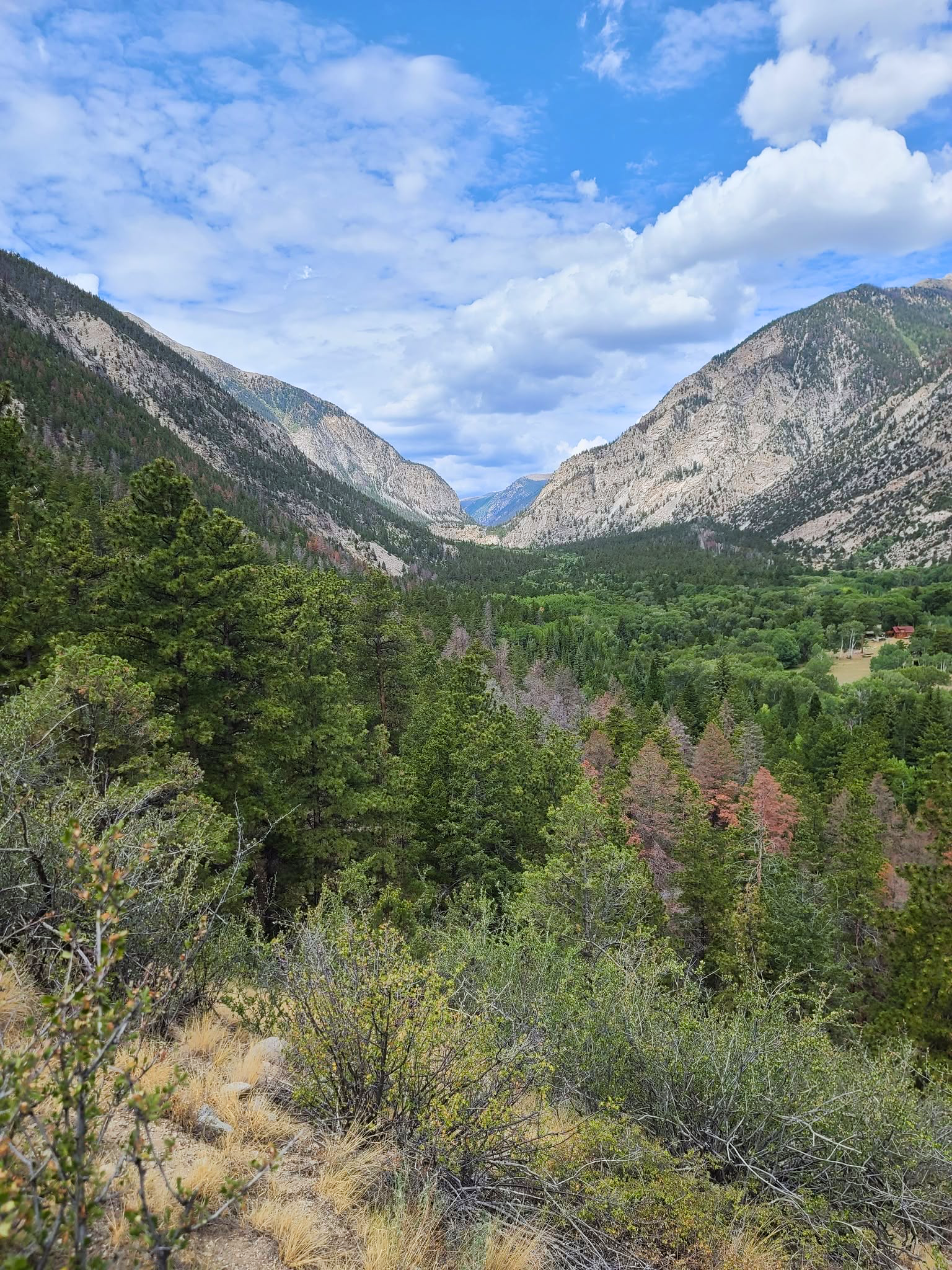
Waterfall Hike
Agnes Vaille Falls
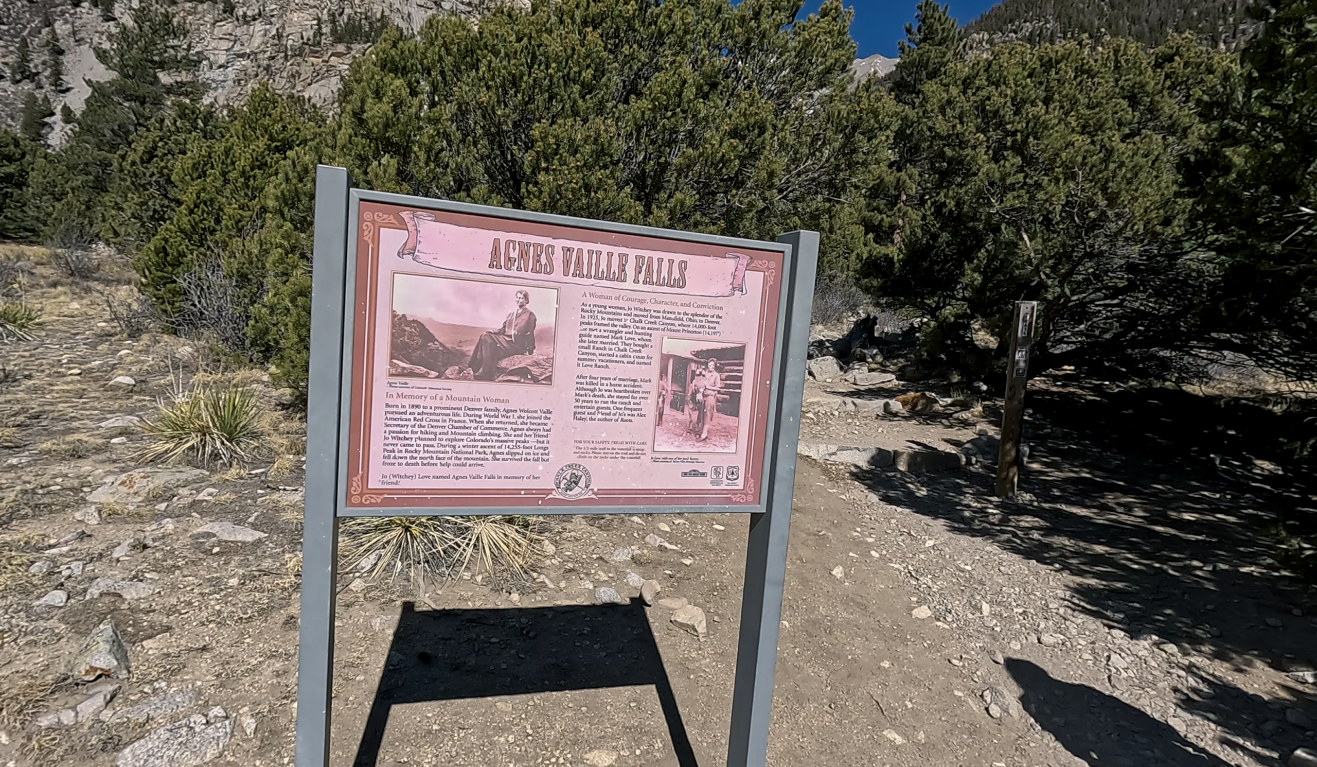
Agnes Vaille Falls drops from the steep southern side of Mount Princeton above Chalk Creek Canyon.
The hike is short, roughly a mile round trip, but gains elevation quickly as it climbs through forest and rocky terrain toward the waterfall viewpoint.
Spring snowmelt and early summer usually produce the strongest waterfall flow. Later in the season, the falls can become much smaller.
This area deserves extra caution. A major rockslide killed five hikers here in 2013. The route was changed afterward, and active rockfall remains a hazard.
Stay on the designated trail and viewing area. Do not scramble up the talus or continue toward the base of the waterfall.
Not Actually Chalk
The Chalk Cliffs
The pale cliffs above Chalk Creek are one of the most recognizable features of the canyon, but they are not made of chalk.
The cliffs are highly fractured rock from the Mount Princeton area that has been altered by geothermal water moving through faults beneath the mountain.
That alteration produced pale minerals including kaolinite, giving the cliffs their white, chalk-like appearance.
The same faulted landscape helps explain the natural hot water found along Chalk Creek today. Geology, hot springs, and the appearance of the canyon are all closely connected.

Trail Crossroads
The Colorado Trail at Chalk Creek
The Chalk Creek Trailhead is one of the major road crossings of the Colorado Trail through the central Sawatch Range.
Heading North
Colorado Trail Segment 13
Segment 13 ends at Chalk Creek after traveling south through the Collegiate Peaks from the Silver Creek Trailhead.
A short out-and-back from Chalk Creek can provide a taste of the route without committing to an entire segment.
Heading South
Colorado Trail Segment 14
Segment 14 begins at Chalk Creek and runs approximately 20 miles south toward US Highway 50.
The route crosses the lower Sawatch Range and passes access points toward Browns Creek, Mount Shavano, and other mountain trails.
Day Hike
Climb Above the Canyon
You do not need to hike an entire Colorado Trail segment. A shorter out-and-back from the trailhead quickly gains elevation and opens views toward the Chalk Cliffs and surrounding peaks.
At the End of the Canyon Road
St. Elmo
St. Elmo grew from the silver mining boom that reached Chalk Creek Canyon in the 1870s.
Originally platted as Forest City, the town expanded rapidly during the 1880s as mines and railroads pushed deeper into the mountains. The Denver, South Park and Pacific Railroad connected the settlement with the outside world and helped support the surrounding mining district.
Mining eventually declined, but enough buildings survived for the St. Elmo Historic District to preserve an unusually complete look at a Colorado mountain mining town.
Walk the streets, look at the historic buildings, and use St. Elmo as the dividing line between the easier canyon drive and the rougher roads leading farther into the mountains.
Explore St. Elmo history →
Above St. Elmo
Hike the Old Railroad Toward Alpine Tunnel
The railroad story continues far beyond St. Elmo.
Forest Road 295 follows the old railroad corridor south toward the former townsites of Romley and Hancock. At Hancock, motorized access ends on the historic railroad grade toward Alpine Tunnel.
Alpine Tunnel Trail #1438 follows the Denver, South Park and Pacific grade for about 2.8 miles to the caved-in eastern portal of the tunnel.
The grade itself is relatively gentle, but the trailhead is already above 11,000 feet. High elevation, exposed terrain, snow, wind, and rapidly changing weather make this a very different outing from the lower canyon hikes.
Interpretive features along the route help explain the enormous effort required to operate a railroad through this landscape.

Choose Your Adventure
How Far Into the Canyon Do You Want to Go?
A Couple of Hours
Hike part of the Narrow Gauge Trail, visit Chalk Lake, or take the short trail toward Agnes Vaille Falls.
Half a Day
Combine one of the lower canyon hikes with a drive to St. Elmo and time exploring the historic townsite.
A Full Day
Continue from St. Elmo toward Hancock and hike the old railroad grade toward Alpine Tunnel.
This takes you from the Arkansas Valley foothills into true high-country terrain near the Continental Divide.
Getting Around
The Road Changes as You Go
Do not assume that every road leaving St. Elmo is comparable to County Road 162.
County Road 162
This is the main access through Chalk Creek Canyon toward St. Elmo. Conditions can still change with weather, snow, runoff, and road work.
Beyond St. Elmo
Roads toward Hancock, Tincup Pass, Pomeroy Lakes, and other high-country destinations become much rougher.
Some routes require high-clearance four-wheel-drive vehicles and experienced mountain driving.
Check Before You Go
Snow can block high roads well into summer, and storms can change road conditions quickly.
Chaffee County road information →Stay in the Canyon
Camping Along Chalk Creek
Several developed Forest Service campgrounds make Chalk Creek Canyon a good base for hiking and exploring the surrounding mountains.
Mount Princeton Campground
A wooded Forest Service campground beside Chalk Creek in the lower part of the canyon.
Chalk Lake Campground
Camp near Chalk Lake with easy access to fishing, the Narrow Gauge Trail, waterfall hikes, and the road toward St. Elmo.
Cascade & Iron City
Additional developed campsites farther up the canyon put you closer to St. Elmo and the upper mountain road system.
Camping and campfires in the main Chalk Creek Canyon corridor are restricted to designated developed campgrounds. Always check current Forest Service restrictions before your trip.
When to Go
Chalk Creek Canyon Through the Seasons
Spring
Snowmelt brings higher flows to Chalk Creek and stronger waterfall flow, while trails and roads higher in the canyon may remain buried in snow.
Expect very different conditions between Nathrop and the high country.
Summer
Summer offers the best access to the full canyon, including St. Elmo, Hancock, Alpine Tunnel, high-country trails, and developed campgrounds.
Start exposed alpine hikes early because afternoon thunderstorms are common.
Fall
Aspen color, cooler temperatures, and quieter trails make early fall one of the best times to explore the canyon.
Snow can arrive much earlier around St. Elmo and Alpine Tunnel than it does in Nathrop.
Winter
The upper canyon becomes winter recreation terrain. The historic Stage Coach Road between Alpine and St. Elmo is used for cross-country skiing and snowshoeing.
Roads and trails farther into the high country may involve avalanche terrain and should not be treated like their summer versions.
Before You Go
The Canyon Changes From Valley to Alpine
A day in Chalk Creek Canyon can begin in warm, dry conditions near Nathrop and end above 11,000 feet in cold, exposed mountain weather.
Bring Layers
Temperatures drop quickly as you climb west into the mountains. Carry warm and waterproof layers even when Nathrop is warm.
Watch the Weather
Thunderstorms become a serious concern around Hancock, Alpine Tunnel, and other exposed high-country destinations.
Respect Rockfall Areas
The steep and highly fractured canyon walls can produce rockfall. Follow all closures and warning signs, especially around Agnes Vaille Falls.
Download Maps
Cell service becomes increasingly unreliable farther into the canyon. Save trail and road maps before heading into the high country.
Explore More
More Around Nathrop
Chalk Creek Canyon sits between some of the biggest mountain terrain in the Nathrop area, with Mount Princeton immediately above the canyon and Browns Creek just to the south.