
Hiking, Running & Mountain Biking
Arkansas Hills Trails
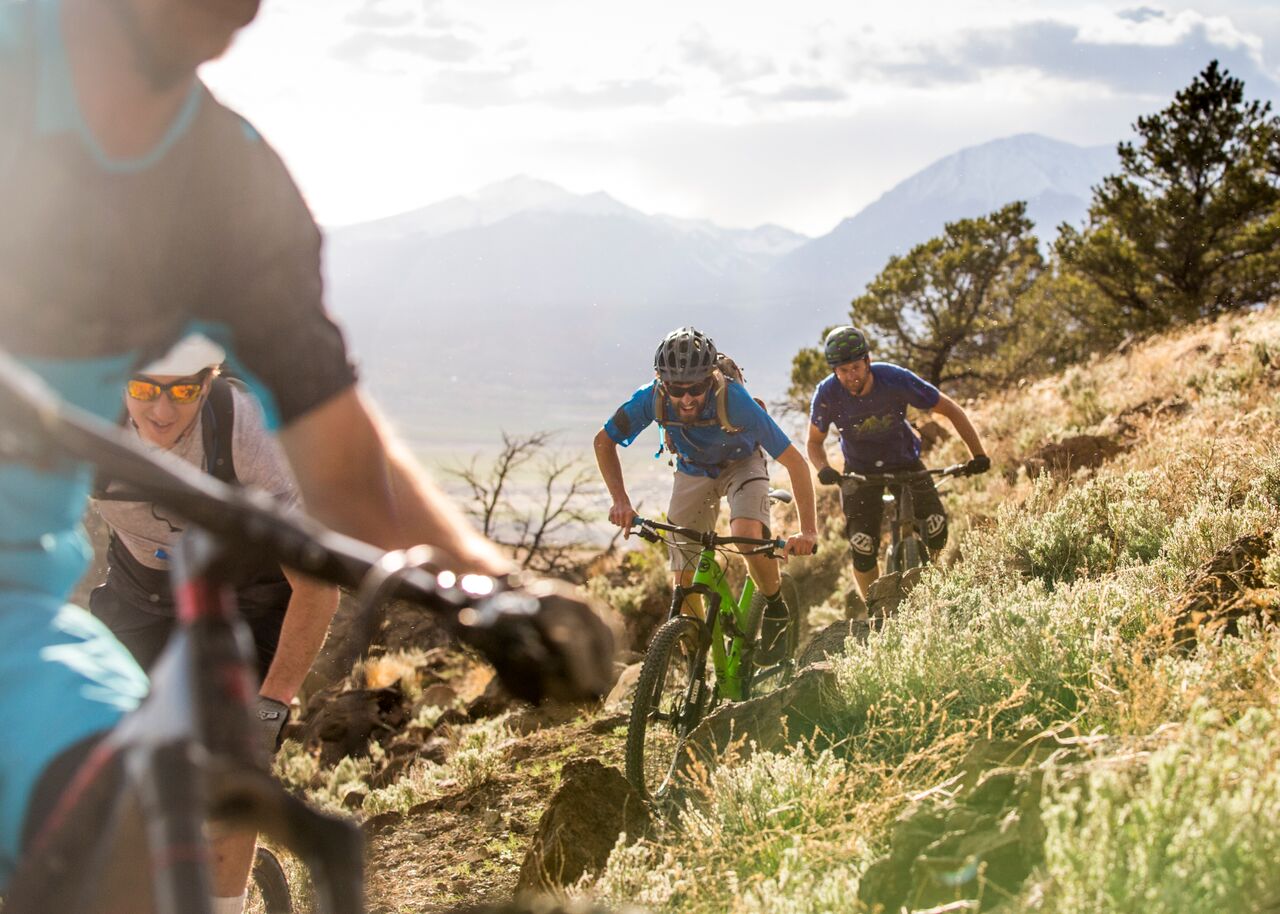
Cross the Arkansas River from downtown Salida and climb directly into miles of rocky singletrack, open foothills, and wide views across the valley.
Photo: Leslie Kehmeier / Bureau of Land Management · CC BY 2.0 · Wikimedia Commons · Cropped for display
Salida's Backyard
From Downtown to Singletrack in Minutes
Look across the Arkansas River from downtown Salida and you will see Tenderfoot Mountain rising above town, easily recognized by the large white "S" on its western slope.
This is the gateway to the Arkansas Hills Trail System, commonly called S-Mountain. Trails climb directly from the river into open, rocky foothills covered with piñon and juniper.
The network was designed as a series of connected loops. Easier and shorter options are concentrated near town, while longer and more technical routes extend north and east into the hills.
You can start with a quick walk above downtown, put together a trail-running loop, or spend several hours mountain biking deep into the system without driving to a remote trailhead.

The Basics
Arkansas Hills at a Glance
Location
Right Above Downtown
The F Street access point sits just across the Arkansas River from downtown Salida, making these some of the easiest trails in the valley to reach without driving.
Trail System
22+ Miles
The Arkansas Hills system contains more than 20 miles of interconnected trails ranging from approachable foothill routes to advanced, technical singletrack.
Best For
Hike, Run & Ride
Most trails are nonmotorized and shared by hikers, trail runners, and mountain bikers, with a few routes reserved for foot traffic.
Terrain
Dry & Rocky
Expect open hillsides, piñon and juniper, exposed rock, loose sections, short steep climbs, and broad views across the valley.
Where to Start
Popular Arkansas Hills Trails
The network has dozens of intersections, so these trails are better thought of as building blocks than individual start-to-finish hikes.
Classic Access
Frontside
Frontside zigzags up the western face of Tenderfoot Mountain and is one of the classic gateways into the Arkansas Hills system.
The climb quickly leaves the river behind and opens views over downtown Salida and the Arkansas River Valley.
Easy Connection
Little Rattler
Little Rattler continues through the lower part of the network and connects Frontside with trails farther around S-Mountain.
It is useful for building shorter loops without committing to the more rugged backcountry portions of the system.
Longer Adventure
Backbone
Backbone extends deeper into the Arkansas Hills and provides access to a much larger collection of connecting trails.
Expect more climbing, rougher terrain, and a more remote feel than the trails immediately above town.
Technical Riding
Hooligan
Hooligan is one of the system's well-known advanced mountain bike descents, with steep grades, rock gardens, exposed slabs, and optional technical features.
This is not a beginner mountain bike trail.
Foot Traffic Only
Backside
Backside gives hikers and trail runners a direct climbing route from the F Street Trailhead toward the back of S-Mountain.
The trail is reserved for foot traffic, providing an alternative to the busier multi-use routes near town.
Explore More
Cottonwood & Chicken Dinner
Farther into the system, trails such as Cottonwood and Chicken Dinner can be combined with Backbone and surrounding routes for substantially longer outings.
Leave the Car Behind
Start From Downtown Salida
One of the best things about the Arkansas Hills is how close they are to town.
From downtown, cross the Arkansas River at F Street and you are essentially at the base of the trail system. Frontside, Backside, Sand Dunes, and other lower trails begin almost immediately.
That makes this a particularly good choice for a morning hike, after-work trail run, or mountain bike ride when you do not want to spend part of the day driving to a trailhead.

Choose Your Pace
Hiking, Trail Running & Mountain Biking
Hiking
For a short hike, climb from F Street into the lower Arkansas Hills and turn around when you have had enough elevation.
For something more substantial, use the connecting trail network to create a longer loop around Tenderfoot Mountain.
Trail Running
The network's interconnected layout makes it particularly good for trail running. Short loops near town can easily be extended by adding trails farther into the hills.
Foot-only routes such as Backside also give runners options away from the busiest bike trails.
Mountain Biking
The Arkansas Hills are one of Salida's signature mountain bike areas, with everything from lower-level flow and climbing trails to steep, rocky technical descents.
Difficulty increases quickly in parts of the system, so use a current trail map and pay attention to individual trail ratings.
Worth the Climb
Big Views Over the Arkansas River Valley
The dry, open terrain of S-Mountain is part of what makes these trails special. Trees are scattered rather than dense, leaving long views across the valley.
From higher sections of the trail system you can look back toward Salida, the Arkansas River, the Sawatch Range, the Continental Divide, and the Sangre de Cristo Mountains.
Early morning and late afternoon are especially good times to be above town, when lower-angle light reaches across the valley and the surrounding peaks.

A Longer Trail Season
Sunny Side of the Valley
The Arkansas Hills sit on the dry side of the valley and receive substantial sun, giving the lower trails a much longer season than many high-country routes around Salida.
Spring
Lower Arkansas Hills trails can become usable while higher mountain trails are still covered by snow.
Avoid soft trails during spring thaw and after wet weather.
Summer
Summer mornings and evenings are often the most comfortable time to use the exposed lower trails.
There is limited shade, so carry plenty of water during hot weather.
Fall
Cooler temperatures make fall one of the best seasons for longer hikes, runs, and rides through the Arkansas Hills.
Winter
Some lower trails can remain dry or become rideable between winter storms, but conditions vary significantly with snow, shade, and freeze-thaw cycles.
Before You Go
Check Trail Conditions
Salida's dry climate does not mean the trails are always ready for use. Rain, snow, and winter freeze-thaw cycles can leave sections muddy even when nearby ground looks dry.
Do Not Use Muddy Trails
If your shoes or tires are leaving deep tracks, turn around. Traveling through soft trail surfaces creates ruts and widens the trail.
Seasonal Wildlife Closure
Beasway closes annually from December 15 through March 15 to protect wintering wildlife.
Other closures can change, so always check posted signs and current trail information.
Carry a Map
The Arkansas Hills contain many junctions and connecting trails. Download a map before leaving town if you plan to venture beyond the lower trail network.
Local Trail Stewardship
Who Builds and Maintains These Trails?
Salida Mountain Trails is the local nonprofit that works with public land managers and the community to build, maintain, and improve nonmotorized trails around Salida.
Its work extends beyond the Arkansas Hills to Methodist Mountain, portions of the Rainbow Trail, and other trails throughout the Salida area.
Trail construction, maintenance, erosion repair, signage, and volunteer work are a major reason the local trail network exists in its current form.
Visit Salida Mountain Trails →
Explore More
More Trails Around Salida
The Arkansas Hills are only one part of Salida's trail system. Head south for Methodist Mountain or west toward the Continental Divide for higher-elevation hiking.